Sangamon County Tax
Parcel Viewer
The Sangamon
County Tax Parcel Viewer allows the public, realtors, appraisers, title
researchers etc. the ability to access the Sangamon County Tax Parcel
information and maps via a desktop browser, tablet (iPad etc.) or mobile
device. This application is browser
based and not an app that you need to download.
Because this
application was designed to be used by many types of devices and browsers, the
interface was created to be simple to use, but at the same time allowing it to
be highly functional.
For those
users using a touch device (i.e. iPad, iPhone Android phone, windows tablet
etc.) please substitute the desktop browser mouse nomenclature with the
corresponding touch device gestures such as tap, tap and drag, pinch, etc.
The Map:
The
application is always ready for the user to click, pan or zoom on the map. You will notice that there are not any tools
for panning, zooming or selecting a parcel.
That is because the application was designed to be intuitive and always
assuming that if you click on the map
you want information about a parcel.
The application assumes that if you click on the map and move the mouse
that you want to pan around on the map.
If your mouse has a scroll wheel then you can use that to zoom in and
out on the map. There is also a zoom in
and out control located in the upper left hand corner of the map.
To interact
with the map you can:
1) Clicking the left mouse button on the
parcel of interest. This will do one of
two things:
a) Display an information box displaying
relevant information about the selected parcel.
Such as PIN number, owner name, address etc. (More on this later)
b) If you clicked on a Condominium
parcel you will see a list of all the units displayed along the left hand
portion of the screen. If you left click
your mouse on any of the records displayed then you will see the information
box related for that tax parcel record as described in item “a” listed above.
The Toolbar:
The toolbar
is made up of 7 Tools or Buttons. The
tools are from left to right:
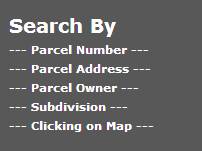
1) Search by (Default): Parcel number, address,
owner, subdivision or mouse click
2) Location
3) Zoom to Lat Long
4) Measure
5) Create Map
6) Switch Basemap
7) Help

![]() The “Search Parcel” button is the
default state when the application first loads.
The application is always ready for the user to click, pan or zoom on
the map. But if you are looking for a
particular parcel, owner, subdivision or address then you can select one of the
other four search methods:
The “Search Parcel” button is the
default state when the application first loads.
The application is always ready for the user to click, pan or zoom on
the map. But if you are looking for a
particular parcel, owner, subdivision or address then you can select one of the
other four search methods:
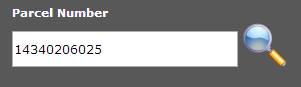
1) Parcel
Number: To search by parcel number hover your mouse over the Parcel Number
label and left click your mouse. This
will bring up the “Parcel Number” input box.
Enter a parcel number (must be between 10 and 11 digits). This parcel number should be all numeric
characters, without spaces or other special characters such as 14340206025 and
press Enter (Or tap the Search Icon next to the input box) such as:
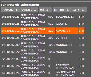
Once you click on the “Search” icon or press “Enter” the Tax Parcel
Viewer will search for you Parcel Number within the County’s tax system. If the parcel is found, the parcel will be
selected (it will turn orange) and the map will zoom to display that parcel on
the map and the “information box” with its pointer will be shown on the map.

2) Parcel
Address: To search by parcel address, hover your mouse pointer over the
Parcel Address label and left click your mouse.
This will bring up the “Parcel Address” input box. Enter the parcel address and press Enter.
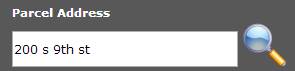
Just enter the street address without the City, State or Zipcode. There are 3 to 4 parts to the address: House number, direction (if used), Street
name, and street type. The address shown
in the example above includes the street direction. If you omit the street direction you will get
more results.
3) Parcel
Owner: To search by parcel owner,
hover your mouse pointer over the Parcel Owner label and left click your
mouse. This will bring up the “Parcel
Owner” input box. Enter the Parcel Owner
and press Enter. (The Parcel Owner
should be entered last name first space and then first name. The application will return all tax parcel
records that match. If only one record
matches your query then that tax parcel will be selected and the map will zoom
to that parcel and display the information box.
However, if more than one record matches your query then you will get a
list of parcels, names and address to choose from.
More than one record matches your query so select from the list.
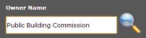
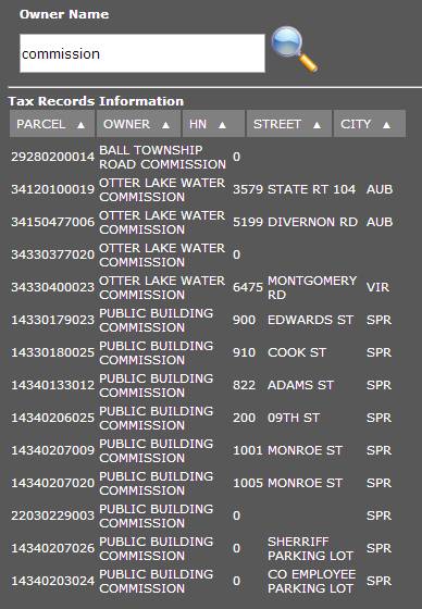
To further clarify the searching possibilities. If you were to enter just the name
“Commission” in the Owner Name input box, you would receive a list of tax
parcel records that contains “Commission” ANYWHERE in the owner name such as in
the following example:
In this example we searched for an owner name that contains “commission”
anywhere in the owner name.
4) Subdivision: To search by subdivision name, hover your
mouse pointer over the Subdivision label and left click your mouse. Enter the name (or part of the name) in the
input box to perform your search. If
only one subdivision matches your search query then that subdivision will be
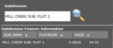
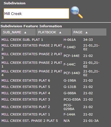
selected (orange) and the map will zoom to that area. In the example below we search for Mill Creek
Sub. Plat 1. But we could have
searched for Mill Creek.
Example using the exact name of the Subdivision as stored in the tax
system.
This is an example using just a portion of the actual subdivision name.
Whenever you
have selected a tax parcel, an information window will display that will give
you some information about the parcel, such as:
1) PIN – Property Identification Number
2) Owner Name 1
3) Owner Name 2
4) Property address information
5) Mailing address information
6) Legal description (condensed version)
7) Farm acres (if any)
8) Non Farm acres (if any)
9) Class code and Class description
10) Township Code
11) Township name.
If you are need
further information about the selected parcel then, press the “Parcel Links” button at the bottom of
the Parcel Information Window.
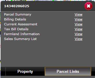
On the “Parcel Links” page you will be given
many options for different types of tax information related to the selected
parcel, such as:
1) Parcel Summary – This is a very useful page
and gives you most of the information you want about a parcel just by going to
this page.
2) Billing Details – This link will take
you to the page that just displays the Current Billing Details. This
information is shown in the Parcel Summary.
3) Current Assessment: This
information is shown in the Parcel Summary.
4) Tax Bill Details: This is a very useful page. It shows you breakdown of the taxing entities
and the current and previous year’s tax rate.
5) Farmland Information: This is page is useful for farm related
parcel. If the parcel is not a farm
parcel you will receive a message that there are “no farm records for the
selected parcel”.
6) Sales Summary List: This is very useful page. This page will display a listing of sales on
the parcel over time.
![]() The “Location” button is used
to acquire your location from your browser / GPS. This function is meant to be used by
tablet and mobile devices.
Your browser will verify that you want to have the application determine
your location. The Tax Parcel Viewer
will then use your location to select the parcel just as if you clicked the
point on the map. Be aware that there
are areas that do not have a tax parcel such as some road right of ways. If you are in a car and use this function you
may not get a parcel selected because you are in the right of way. But the map will zoom to your location. (The
Location returned is only as good as the GPS accuracy of your device!!). 887
The “Location” button is used
to acquire your location from your browser / GPS. This function is meant to be used by
tablet and mobile devices.
Your browser will verify that you want to have the application determine
your location. The Tax Parcel Viewer
will then use your location to select the parcel just as if you clicked the
point on the map. Be aware that there
are areas that do not have a tax parcel such as some road right of ways. If you are in a car and use this function you
may not get a parcel selected because you are in the right of way. But the map will zoom to your location. (The
Location returned is only as good as the GPS accuracy of your device!!). 887
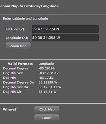
![]() The Zoom
to Latitude and Longitude button allows you to type in latitude and
Longitude and the map will zoom to that location (as long as it is within the
confines of Sangamon County). You can
enter the latitude and longitude in many different formats. Once you enter your information then click on
the “Zoom Map” button. You can also,
use this tool to find out the Latitude and Longitude anywhere on the map. Press the “Click Map” button and then click
on a point on the map that you wish to know the Latitude and Longitude. A red symbol with a yellow outline will be
placed where you clicked and the latitude and longitude will be displayed in
the input boxes.
The Zoom
to Latitude and Longitude button allows you to type in latitude and
Longitude and the map will zoom to that location (as long as it is within the
confines of Sangamon County). You can
enter the latitude and longitude in many different formats. Once you enter your information then click on
the “Zoom Map” button. You can also,
use this tool to find out the Latitude and Longitude anywhere on the map. Press the “Click Map” button and then click
on a point on the map that you wish to know the Latitude and Longitude. A red symbol with a yellow outline will be
placed where you clicked and the latitude and longitude will be displayed in
the input boxes.
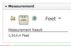
![]() The Measure
tool is used to determine an “approximate” area, or distance. Select which type of measurement you want to
make. Then click once on the map at the
place you want to start measuring from and then double click the map at the
point where you want to end your measurement.
The measurement will be displayed in the “Measurement Result” area.
The Measure
tool is used to determine an “approximate” area, or distance. Select which type of measurement you want to
make. Then click once on the map at the
place you want to start measuring from and then double click the map at the
point where you want to end your measurement.
The measurement will be displayed in the “Measurement Result” area.
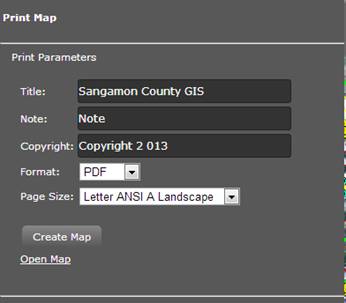
![]() The Print
tool is used to actually create a PDF document of the map as displayed on
your screen. You can enter a title for
your map. The default title is set to
“Sangamon County GIS”, You can add a note. If a parcel is selected then the Note will be
populated with the Parcel Number of the selected parcel. You can choose from 1 of 4 different page
sizes. Select the desired page size and
output format and press the Create Map button.
This will generate a link “Open
Map” that will appear below the “Create Map” button. Click on the “Open Map” link to display the
map. You can then print the map or save
it.
The Print
tool is used to actually create a PDF document of the map as displayed on
your screen. You can enter a title for
your map. The default title is set to
“Sangamon County GIS”, You can add a note. If a parcel is selected then the Note will be
populated with the Parcel Number of the selected parcel. You can choose from 1 of 4 different page
sizes. Select the desired page size and
output format and press the Create Map button.
This will generate a link “Open
Map” that will appear below the “Create Map” button. Click on the “Open Map” link to display the
map. You can then print the map or save
it.
![]() The Basemap
selector is used to switch between different basemaps. It is also used to add any available dynamic
layers. There are 6 basemaps to choose
from.
The Basemap
selector is used to switch between different basemaps. It is also used to add any available dynamic
layers. There are 6 basemaps to choose
from.
1) 2011 Aerial photography: This is the default basemap.
2) 2003 Aerial photography (with current
parcels displayed in white)
3) 2007 Aerial Photography (with current
parcels displayed in white)
4) 2007 Topographic map (with 2’
Contours and building footprints)
5) Current Farmland Use
6) 1938/1940 Aerial Photography
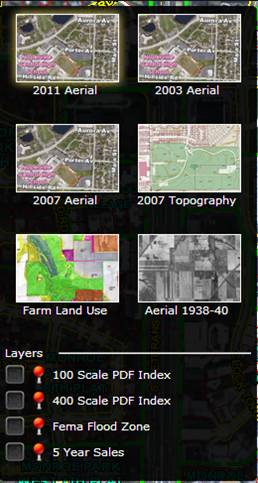
At the
bottom of the Basemap selector there is an area for layers that can be overlaid
on the map.
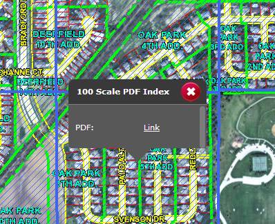
1) 100 Scale PDF Index. This index is used to display the 100 sale
map pages available for downloading.
Each blue hatched square is a map page. Click on one of the blue hatched
squares and an information box will be displayed with a link that will allow
you to download official tax map (PDF) for that area.
2) 400 Scale PDF Index: 100 Scale PDF
Index. This index is used to display the
400 scale map pages available for downloading.
Each red hatched square is a map page. Click on one of the red hatched
squares and an information box will be displayed with a link that will allow
you to download official tax map (PDF) for that area.
3) 100 year FEMA Flood Zones.
4) 4 Year Sales: This layer displays
parcels (excluding condominiums) that have sold over the last 4 years (static
snapshot). The parcels that meet the
state criteria are displayed by their ratio at the time of sale.
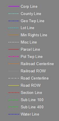
Main Legend
![]() The Help tool is used to display the help document
which includes this document.
The Help tool is used to display the help document
which includes this document.